
 |
| The tiny Waddah Island Lighthouse stands on a cleared spot 63 feet above water on the west end of the island. Photo taken in 2002 by www.seaotter.com |
My interest in the island concerns the little lighthouse that sits on the northwestern end. It had a fog signal years ago, but I believe that's gone now. When I lived in Washington, I made the long drive to Neah Bay several times and attempted to get across the breakwater from Baada Point to Waddah Island, without success. The weather usually foiled my attempts (or a sensible husband who knows how clumsy I am). So I was never able to visit the light up close. Every summer, the Coast Guard families at Neah Bay have a picnic on Waddah Island. I was invited to join them one summer, but as luck would have it, a heavy summer fog rolled in dense as pea soup, and the picnic was held ashore.
Here are some maps to help you orient the location of the island and lighthouse.


The lighthouse was established in 1877 as a post beacon, a very common navigational aid at this time in the Northwest. An eight day lens-lantern light hung from the post. It's likely the lifesavers stationed on the island tended the beacon.
In 1888, because of the many perils around the island, buoys were anchored. Here's a report from the U.S. Lighthouse Board. It includes other locations in Washington.

The lifesaving service set up a manned station on Waddah Island in 1877 after the U.S. Government had purchased the island (1860). So many wrecks occurred inside the entrance to the strait, lifesaving services were needed. The lighthouse at Cape Flattery helped ships find the entrance to the strait, but once inside, they were on their own until they sighted Slip Point Lighthouse at Clallam Bay. If there was fog, or a storm raging, it was easy to go aground on the many rocks inside the entrance to the strait.
 |
| Slip Point Lighthouse was some 30 miles east of Waddah Island. It's lighthouse was in service from the early years of 1900 until about 1940 when a landslide pushed it into the strait. Note the foghorn--a necessity on the Strait of Juan de Fuca. (Photo from the Coast Guard Historian.) Today, the light is on a steel tower. |
 |
| An old postcard shows the lifesaving station after it was moved to Baada Point. |
Among the rocks mariners had to avoid were the fingers of Waddah Island, extending northwest off the island. They were not only a danger if passing vessels ran off course, they also endangered ships headed into the small harbor at Neah Bay. For a look at the Waddah Island Fingers, click here. You'll also see the breakwater and Waddah Point, where the lighthouse sits.
Here's a picture of a ship wrecked on the "fingers" in 1910 at Waddah Island. Photo courtesy of the Nautical Research Center.--

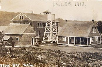
At various times over the years, people have resided on Waddah Island. The Makah gardeners and fishermen were there, of course. Then the lifesavers came in 1877. They left in 1910 when their station was moved to Baada Point.
A few residents remained, but by World War II everyone was gone. The Coast Guard continued to maintain the tiny lighthouse, but keeping the pathway clear up to the lighthouse was a challenge. The solution was to station a few goats on the island. The photo below, given to me by the Coast Guard Museum Northwest, shows those rowdy goats, with their big appetites for salal, blackberry bramble, and other invasive plants. A Coastie holds them by their horns. Otherwise, they'd be pummeling and butting him.
 |
| The goats must have reproduced because even in recent years they've been reported on the island. They greet visitors and mooch food. Be careful if you meet them. They can be overwhelming! |
In 1944, the U.S. Army Corps of Engineers built the breakwater between Waddah Island and Neah Bay. It made the tiny harbor much calmer. It also gave interested hikers a way to reach the island...that is if the weather is cooperative. It's a very slippery hike, so if you go, be careful. And don't tell any wardens I sent you!
While you're in Neah Bay, visit the Makah Cultural Center. It has a fascinating history of the tribe and archaeological artifacts from an old village exhumed at Ozette. Nearby is the town store where you can get lots of goodies, including ice cream.
Then drive to the parking area at the trailhead for Cape Flattery Lighthouse and park. (I think there's a fee. Ask anyone in town for directions if you don't see the sign for the trailhead.) Walk the plank-board trail through the ancient forest to a viewing landing for the lighthouse. On one of my visits to the landing, there was a wedding party getting hitched. They wanted to tie the knot with their fave lighthouse in view.
 |
| Photo from the Makah Nation |
 |
| The view from the landing. This is a postcard from the 1970s when the trail to the viewing spot was just a muddy path through the woods. Today, it's much nicer. |
No comments:
Post a Comment
I welcome your comments, photos, stories, etc.!