Tuesday, February 18, 2014

A Star to Steer By...

We all enjoy visiting and photographing lighthouses. We take pictures mostly by day. It's easy in the daytime. No special equipment needed.

But at night lighthouses become fantastic objects for the camera! And, of course, night time is when they do their most important work. Why else would they need lights if not to help the navigator in fog, rain, snow, and darkness?

Catching a lighthouse at night with your camera is no easy task. I've tried numerous times with various types of cameras, with moderate success. (All of my night shots are slides, else I'd post some here.) A tripod is essential for night pictures, as is patience. Sky conditions need to be right too. Even then, I often end up with blurry, less than eye-popping images. What my eye catches seems not what my camera catches. A camera can catch more or less of what we see, I think. 

Digital cameras now do much of the work that skilled photographers once did. I've worked with several photographers who were assigned to do the pictures for some of my books. They all eschew digital photography and still create images the old-fashioned way with 35mm cameras and lots of equipment in cases and trunks. One of them admitted, though, that he uses "some software" to refine his images.

Yes, a little Photoshopping can make those night pictures pop, sometimes garishly....but delightfully too. What does a mariner really see when looking at a lighthouse from sea? What does the casual beach-goer see looking at a lighthouse from land? I doubt they see what's below. (Image of Pigeon Point Lighthouse, California, from Holidayaholic on Flicker. No derision is intended by my comments; this is a lovely image. I just think it's not what we would see with the human eye, especially with a blue sky in the background and clear air.)


A good foggy night will show us the beams revolving around the lantern (see Jennifer Oakes' Point Carbillo photo farther down the page), and perhaps we'd see a faint outline of the beams on a clear night (below), probably only if we stood under or near the lantern, as a guy named Martys did to take this shot, shared on www.downeast.com. It's all about perspective--where you are when you view the lighthouse. This is a wonderful image below, and I have indeed seen this effect at lighthouses. The moisture in the ocean air can illuminate the beams like this. The lighthouse Martys caught in his camera lens is the pretty one at West Quoddy Head, Maine. Check out his other image to see what happened at a short distance from the tower. The effect of the beams disappeared.


From sea, a lighthouse with a fixed beacon (no flash signature) can look like any other light along the shore, unless a sailor has an intimate knowledge of the coast and a good manual to help identify the lights he/she sees. In the "good old days," there weren't so many lights on the shore at night, and a lighthouse was easy to find. Now, it can be a challenge unless you really know your course. Our shorelines in many places--practically the entire Eastern Seaboard, I think--are all lit up. Cities have become their own lighthouses, sighted by ships long before the simple beams of an old lighthouse are seen.

So, what do lighthouses look like at night? If you haven't seen them for yourself, check out some of these great images of lighthouses doing their nocturnal work--

Here's Portland Head Light, Maine, on Flicker by Matthew Paulson.

Cape Hatteras Lighthouse, North Carolina, was captured here by a National Park Service photographer. The long exposure picked up the background stars and made them slightly elongated as they moved across the sky during the time the camera shutter was open.

Jennifer Oakes captured the fog-reflected beams of Point Cabrillo Lighthouse, California (Flicker). Notice there are no stars in the background. It was probably too murky and misty to see them. You need tiny water droplets, such as fog produces, or a lot of dirt in the air to really catch the beams. A misty evening makes them effulgent like this. At sea, the mariner wouldn't see this effect. The beams would just be flashes.

Here's Sherwood Point Lighthouse in the Great Lakes, pictured on Wikimedia Commons. Those exterior house lights wouldn't have been in use back the lighthouse's heyday. The lighthouse beam is surely more powerful than the house lights, but they'd still be seen some distance away as ambient light.

This UK lighthouse was photographed by Phil Downs. This is what a lighthouse looks like at night, no gimmicks or special effects, even by nature. (Nature doles out extreme grandeur sparingly, you know!)

 
The Cape Neddick "Nubble" Lighthouse is a favorite with shutterbugs. Above is a great photo that appears on http://www.inside-york-maine-vacations.com/nubble-lighthouse.html. 
While it does look as if a software program saturated the color and blackened the sky, I can believe the full moon would be so big--the moon does look bigger near the horizon than high overhead (an optical illusion)--and the red beacon seems about right. You may wonder, who needs a lighthouse when you have the moon??!! Well, mariners in the age of sail did use the moon. They did calculations for a ships' position called "Lunars." They used lots of math, almanacs, and a good nautical clock called a chronometer. It might be easier to use a lighthouse, we think. (However, a lighthouse can't give an exact position like navigating instruments can.)

I am partial to this shot of Block Island's old North Lighthouse, by Michael Blanchette. It looks like a master photographer was at work here--someone patient and well-equipped so that the beacon and night sky was captured in all its glory. Maybe this photo is enhanced--the Milky Way looks a bit too cloudy...or perhaps those are real clouds. I'm not sure. But it's a wonderful photo. Would I see this if I visited the old North Light on a clear night. Not likely. I've been there on several clear nights. It never looked like this. But I can imagine it so....  Can you?

Grab your camera and go lighthouse-ing some night. See what you capture.


Wednesday, February 12, 2014

Lighthouses & Lantern Room Romance


Lighthouses often are described as romantic, meaning they fire our imaginations and lend themselves to stories that tug at our heartstrings. The landmark PBS series, "Legendary Lighthouses," described them this way: "What’s not to love about a lighthouse? Whether it’s for their beauty, romance or usefulness--or a combination of all three--most of us would admit to a fascination with lighthouses."


Lighthouses are romantic places indeed, but in the more familiar sense they're great settings romance--engagements and weddings and quiet getaways. Lighthouses with overnight accommodations like to bill themselves as "romantic hideaways." Events like a "Full Moon Climb" and a "Champagne Tour" appeal to those in love. I admit Jonathan and I (married 41 years now!) have taken more than one picture of ourselves at a lighthouse with happy married faces and arms around each other. The one below was a "selfie" we took at Barnegat Lighthouse in 1998.


If you don't believe that lighthouses can inspire romance, check out the Goodreads "Listopia" called "Light of Love." It lists 72 romance novels set at lighthouses. You'll find them here:
 http://www.goodreads.com/list/show/39694.Light_of_Love_Lighthouse_Romances 
Lighthouses seem to be romantic even in the literal sense. I read Susan Wiggs The Lightkeeper several years ago, because it takes place at Cape Disappointment Lighthouse, the oldest sentinel in Washington and one of the oldest on the West Coast. Wiggs did a decent job with the historical information about the lighthouse and its wild watch at the entrance to the Columbia River, but...it's a romance novel...rife with unrealistic scenes of a lonely lightkeeper rescuing an unconscious and beautiful, scantily clad woman who washes ashore at the foot of his luminous home. He ends up obsessed with her and devotes much more time to wooing than work. No doubt, the local Lighthouse Inspector would have fired him! (Especially if the inspector knew the two were in the lantern having....)


Couples like to get married at lighthouses. The symbolism of strength and safety and caring seems just the right backdrop for tying the knot. In fact, many lighthouses offer wedding packages. It's become a popular practice and provides a tidy stream of income that helps maintain the old towers. My friends, Bill & Vivian Hendersen, were married at North Head Lighthouse. Here they are posing in the lantern, looking wistfully out to sea and dreaming of many happy years ahead. (Photo by Mark Severn)


Lightkeepers got married at their lighthouses; so did their daughters and sisters. Often, there was no time to go ashore to a church or vacation to be had. The honeymoon often took place at the lighthouse too. (This isn't a bad idea, we now think! There are lots of lighthouses where you can have an idyllic honeymoon. Here in Washington we have five of them with romantic lodgings.)


(Photo courtesy of Mystic Seaport Museum, taken in front of their replica of Brandt Point Lighthouse on the Mystic River. There was never an official lighthouse here, but when you're in love, what does it matter??!!)

These joyous events usually received a quick notice in the station logbook, something like: "Assistant Keeper Henry Johnson was married today to Miss Laura Hobson, Principal Keeper's daughter. Principal officiating. Second Assistant James Lambert witness." It wasn't always easy to find a minister, so many principal keepers had the authority to perfom marriages. In lieu of that, someone might row ashore and fetch the preacher. I remember one story that noted the preacher was given a hearty meal after the ceremony, paid a dollar, and taken back ashore that afternoon.

Lightkeeping was a lonely, demanding, and often tedious job, and a wife was not only a companion but a helpmate too. The U.S. Lighthouse Establishment expected a lightkeeper to find a spouse to keep him company and to assist with the work. But finding one wasn't always easy...

(Photo from Jim Claflin, Lighthouse Antiques, of a lighthouse keeper at Nauset, Cape Cod about 1903.)


I interviewed Marjorie Congdon Pendleton in the 1980s about her parents--Lawrence and Amy Congdon--who worked at Little Gull Lighthouse in the 1920s and Watch Hill Lighthouse in the 1930s, both in the Long Island Sound area. (This material went in my book, Guardians of the Lights: Stories of U.S. Lighthouse Keepers.) Marjorie grew up mostly at Watch Hill Lighthouse near the town of Westerly. She told me she was smitten with the handsome Coast Guard men at the station beside the lighthouse. Her parents discouraged any flirtations or serious relationships with the Coast Guard crew, since they were "from out of town.". Their vigilance worked, but under their noses Marjorie struck up a friendship with a carpenter who came to the lighthouse to do some repairs. "One thing led to another," and she married Clifford Pendleton in the living room at the lighthouse in 1937 when she was twenty. Her sister was her maid of honor. (Photo below of the Pendleton wedding shows Marjorie on the right, courtesy of Marjorie Pendleton.)


A year after the wedding, the September equinoctial hurricane of 1938 caused horrendous damage at the lighthouse and also to the community at Watch Hill. This area of Rhode Island was hit the worst when the hurricane came ashore at high tide. Marjorie was stuck in her car during the storm surge with her infant son and was rescued only minutes before the water washed the car into the sea. Her parents dutifully kept the light going during the storm, but their home was badly hit. One of the items damaged beyond repair was Marjorie's wedding dress, which her mother had kept at the lighthouse. So much for lighthouse romance. It was a tough life.


One lighthouse has become synonymous with romance. It's the Minots Ledge Ligthhouse off Cohasset, Massachusetts. This tower has a fascinating history that I'll detail in a later blog entry. For now, I'll simply say the granite tower's flash pattern of 1-4-3 means "I Love You." Couples park on the beach that looks out at the lighthouse, a mile offshore on a submarine foundation of jagged rocks. Sometimes they get engaged or married on the beach. Gift manufacturers have capitalized on the romance of this sentinel and have created all manner of Minots Ledge 1-4-3 trinkets for lovers. One fact about it that might bear mentioning: It's one tough, strudy, and reliable lighthouse...traits that could symbolically represent the "right stuff" needed to be married or together successfully for a very long time.


If you're thinking of making your sweetie a handmade Valentine, check out these from www.alphamom.com. They're clever and cute, with Hershey's Kisses for beacons. I think I want one of these!


Happy Valentine's Day to all the world's lovers!
And a special hug and kiss for my Valentine of many years--
Jon DeWire.


Monday, February 3, 2014

Fair Winds & Following Seas, Ron Foster!

My interest in lighthouses goes back to 1973 when I moved to Maine as a new bride. My husband was stationed at the Brunswick Naval Air Station, and we lived in the little maritime town of Bath. It had a shipyard on the Kennebec River and a wonderful maritime museum. On our jaunts in our '67 Volkswagon beetle, we discovered the area lighthouses. I was fascinated with them....and 41 years later, I still am.

Over the years, I've lived in many places and met many wonderful people who share my love of lighthouses. Sometimes, they contacted me by mail or email or attended my talks. Sometimes, I met them by chance in my travels. Sometimes, I discovered them just down the street. This is how I met Ron Foster--down the road a bit! Back in the mid-1990s, he had a hand in launching a group called NELL--New England Lighthouse Lovers. I knew about the group when it debuted, but I had no idea that a one of the founders lived in my town in Connecticut.

One day, I went to the post office to pick up my mail and found a letter from a man named Ron Foster. He told me he loved lighthouse and was part of a new lighthouse group called NELL. He asked if I would speak at a meeting. I was delighted to not only to speak, but also to meet a group that had formed so close to my home. It was a terrific day when I visited the group at Avery Point, Groton, on a satellite campus of University of Connecticut. I had a special place in my heart for the campus, since I'm a UCONN alum! I gave a talk, signed books, and was so impressed by the passion of this group I donated my speaking fee back to their effort.
This is me on the left, with Ron and his wife, MJ, at that NELL meeting. It was the beginning of a cherished friendship!

Ron Foster has given me many happy experiences and good collaborations. Ron is a fantastic photographer and has allowed me to use his images in several of my books and articles. I went on a few lighthouse tours with him, and we always had fun together sharing our mutual love for the sentinels. A few years ago, when Ron was visiting the Puget Sound area, I invited to my home. That's how special Ron is; I consider him a close friend as well as a cohort in the lighthouse preservation.

NELL eventually became part of the American Lighthouse Foundation. Also part of the effort is the Avery Point Lighthouse Society, dedicated to the restoration and preservation of the the small lighthouse that stands on the UCONN campus at Avery Point, not far from Ron's home. Ron was instrumental in launching the group and helping with restoration of the lighthouse. Much of the work happened after I left Connecticut, but Ron and the group have always kept me informed and included me in their effort. They even gave me an award for my work and an honorary membership in the group. 


The Avery Point Lighthouse was a beacon for me when I returned to college in the 1980s to finish my B.S. and then complete an M.A. I met my mentor there--Stephen Jones (above), a former Coast Guard lightkeeper, author, and professor of English. He supported me through college and my writing career and appears on the cover of my Guardians of the Lights: Stories of U.S. Lighthouse Keepers. We still keep in touch. The photo above shows us together at a an APLHS meeting in 2001. (The lighthouse and moon photo is on the APLS website.)


 Top photo shows restoration work on Avery Point Lighthouse. (Ann Trapani photo) The bottom before-and-after images, are by Ron Foster, showing how the lighthouse looks after the APLS funds and work returned it to its former beauty.  

The lighthouse was built in 1944 and was lighted from 1944 until 1967. It sat neglected for nearly forty years. APLS spent several million dollars to restore it, and they relighted it in 2006. This is the kindest act anyone or any group can do for a lighthouse--rekindle its beacon. It's like returning sight to the blind, I think.

You can learn more about this special little lighthouse and its active preservation/education group at www.averypointlight.com.

Ron Foster sent me an email this past weekend to say he is retiring from his job at Electric Boat after more than 40 years of work there. Today, February 3rd, is his first official day of retirement. I hope he's having fun today, and I suspect he's doing something "lighthouse." I know he is planning many lighthouse trips and projects for the coming years. And he'll continue to work tirelessly for the Avery Point Lighthouse Society. Some of the kindest, most dedicated and hardworking people I know are "lighthouse folks." Ron is among them.

Have fun in retirement, Ron. You deserve it. And keep shining as you always have! (Photo below taken in 2001 by Ron Drummond)


Wednesday, January 29, 2014

The Great Olympic Blowdown of January 29, 1921


On this day in 1921, a massive storm struck the Pacific Northwest, bringing hurricane-force winds and rain. It remains the most severe storm for the region on record.

Great windstorms in the Northwest are called “blowdowns,” due to the vast acres of timber these storms can destroy. Evergreens, as well all know, don't lose their foliage in winter like deciduous tree do; thus, evergreens present more resistance to wind and can be weighted down by snow and ice. Their root systems, made sodden by wet winters, also make them more vulnerable to toppling in big storms.

The January 21, 1921 blowdown killed a number of people, destroyed property all along the coast and inland, and knocked down billions of board feet of timber, the remains of which are still visible on the Olympic Peninsula landscape today. Even a herd of 200 elk were killed by the falling limbs and trees. One of the latent effects of the blowdown were forest fires the following summer—rampant walls of flame that swept through the dried up downed timber as if it was straw.
(Photos from the Washington Forest Protection Assoc. and Wikimedia Commons)


The storm tracked from the southwest and made a direct hit on Vancouver Island just south of Clayoquot Sound. Winds were clocked as high as 120 to 150 miles per hour. Many lighthouses were affected by this storm, including the lights at Cape Disappointment and North Head at the entrance to the Columbia River, the lights at Willapa Bay, Grays Harbor, and Destruction Island on the central Washington coast, Cape Flattery Lighthouse at the entrance to the Strait of Juan de Fuca, and all of the lighthouses on the western shores of Vancouver Island, of which Cape Beale Lighthouse (above) and Carmanah Lighthouse felt the worst winds.

North Head Lighthouse had a large weather station and radio station at the time. A weather observer named Hill wrote:


At 8 a. m. on January 29, 1921, small craft warnings were displayed as ordered by the district forecaster. At 11:40 a. m., local time, a special observation was taken and sent to the district forecaster. At this observation the sea-level pressure was 29.43 inches. The two-hour pressure change was -0.16 inch. Wind east 24 miles per hour. The barometer continued to fall rapidly until about 2 p. m. when it seemed that the center of the low had been reached, and fell very slowly. Near 2:30 p. m., as no orders had been received to change the warnings and the barometer had almost stopped falling, I concluded that the storm was similar to the one of January 16 and 17. We were in need of some supplies and the mail from Ilwaco. By using the car it required about one hour to make the trip to the post office and return. At 2:40 p. m., Mrs. Hill and I left the office. After getting the mail from the post office and a few articles from the stores in Ilwaco we started for home, but the extreme low air pressure probably affected the motor of the machine and a short delay from this cause probably saved our lives.

 
Art.com photo

The road from Ilwaco to North Head is through a heavy forest of spruce and hemlock timber for some distance. On the return trip shortly before reaching the heavy timber, the wind came with quite a heavy gust. We saw the top of a rotted tree break off and fall out of sight in the brush. About this time (near 3:20 p. m.) we were overtaken by a young man from the naval radio station at North Head who was driving a car. It is dangerous driving over this road under favorable conditions. We proceeded very slowly and with great care, passing over some large limbs that had fallen and through showers of spruce and hemlock twigs and small limbs blown from the trees. We soon came to a telephone pole across the roadway and brought our car to a stop, for a short distance beyond the pole an immense spruce tree lay across the road. We left the machines and started to run down the road toward a space in the forest where the timber was lighter. Just after leaving the car, I chance to look up and saw a limb sailing through the air toward us; I caught Mrs. Hill by the hand and we ran; and instant later the limb, which was about 12 inches in diameter, crashed where had stood. In three or four minutes we had climbed over two immense tree trunks and reached the place in which I thought was our only chance to escape serious injury or possibly death. The southeast wind roared through the forest, the falling trees crashed to the ground in every direction from where we stood. Many were broken off where their diameter was as much as 4 feet. A giant spruce fell across the roadway burying itself through the planks within 10 feet of where we stood. Three tops broke off and sailed through the air, some of the trees fell with a crash, others toppled over slowly as their roots were torn from the earth. In a few minute there were but two trees left standing that were dangerous to us and we watched every movement of their large trunks and comparatively small tops.


Between 3:45 p. m. and 3:50 p. m. the wind shifted to the south and the velocity decreased to probably 100 miles or it may have been as low as 90 miles per hour. Shortly after 3:50 p. m. we started toward North Head. We climbed over some of the fallen trunks, crawled under others, and pushed our way through tangled masses of tops that lined the roadway. We supposed that all the houses at North Head had been leveled and the wireless station demolished for we knew that the storm was the most severe that had occurred in the vicinity of the mouth of the Columbia within the last 200 years. Mr. Seui, the young man from the radio station who was with us, hastened through the obstructions, and Mrs. Hill and I proceeded more slowly. About one-fourth of a mile from the station we were met by one of the men from the radio station, who had come to assist us had it been necessary. At 4:40 p. m. we arrived at the assistant lightkeepr's home where all the families of the Head had gathered for safety.

  
redbubble.com photo
The Weather Bureau in Washington reported the following conditions at North Head and Cape Flattery (Tatoosh Island), where equipment could accurately measure pressure and wind:


North Head, WA: The lowest pressure of 28.90" was reached at 15:30 PST, about 2.5 hours later than the Sierra. Before 15:20, the highest wind velocity was 40 (33) mph, and it only took twelve minutes more for the wind to elevate to a 5-minute velocity of SE 126 (92) mph, with an extreme 1-minute average at 150 (106) mph. The anemometer was destroyed by a falling wireless tower before maximum winds had been attained by the storm. Applying a 1.3 gust factor to the 92 mph 5-minute average wind suggests that peak instant velocities approached 120 mph--and may have been higher (the 1.3 gust factor was developed using 1-minute average gspeeds; I'm being conservative here, mainly due to uncertainties in the 4-cup to 3-cup adjustment at such high wind speeds).

Tatoosh Island, WA: Minimum pressure 28.78" at 19:00 PST, and maximum 5-minute winds of SW 110 (83) mph at the same time, with possible instant gusts around 108 mph.

Author Photo, taken on a nice day in March 2004.
Cliff Maas, a meteorologist at the University of Washington, and Brigid Dotson wrote that weather instruments at North Head Lighthouse “indicated a sustained wind of 98 kt, with estimated gusts of 130 kt before the anemometer was blown away
[1]. Although the coastal bluff seaward of North Head may have accelerated the winds above those occurring over the nearby Pacific, the extensive loss of timber around the lighthouse and the adjacent Washington coast was consistent with a singular event. At Astoria, on the south side of the Columbia, there were unofficial reports of 113 kt gusts, while at Tatoosh Island, located at the northwest tip of Washington, the winds reached 96 kt.”
 
A footnote to the story: I was in the coast town of Grayland, Washington a few weeks ago for a conference and spent the night with a friend, whose home sits high on a hill overlooking the town and the Pacific Ocean. There was a big windstorm that night with sustained winds of 40-50 mph and gusts of 60-70 mph. The roar of wind was unbelievable, with so many trees and buildings to amplify its sound, rain assailed the windows and roof all night, and the house rattled and vibrated when gusts hit it. My host assured me this was not an "unusual storm" for the Washington coast in winter. There are always one or two strong storms like this every year. But...
It was a baby storm compared to the Great Olympic Blowdown of 1921!


Thursday, January 23, 2014

Please Pass the Pie...and the Coffee Too

There's a "national day" for everything, it seems. Today is National Pie Day. I like that. I'm a big fan of pie. It's often a wholesome dessert. Just last evening my husband and I consumed the last two pieces of a custard pie I made on Monday. We have a flock of hens that provide us with rich, delicious eggs--perfect for custard. I have fond childhood memories of eating custard my mother made from her hens' eggs, and chocolate pie my Aunt Grace made from our hens' eggs, and tapioca pudding my grandmother made....  (Read my eBook The Funky Chicken: Memories, Truth, & Tribute to be amused by a childhood spent caring for a big flock of chickens and a cache of chicken and egg recipes from my family. Find it on Amazon at http://www.amazon.com/Funky-Chicken-Memories-Truth-Tribute-ebook/dp/B00FAS4U6W/ref=sr_1_1?s=books&ie=UTF8&qid=1390509052&sr=1-1&keywords=the+funky+chicken+dewire)

But...back to pie. Pie and coffee. These were staples at lighthouses, of course. Coffee was always kept hot on the stove at every lighthouse. A lightkeeper never knew when he or she might rescue a castaway or have to work in the bitter cold weather. Lighthouse keepers guzzled a lot of coffee. And they ate lots of pie too. They worked hard and needed lots of calories.

I collect recipes from current and former lightkeepers, and from their descendants, because foodways are important in any pursuit or lifestyle, the lighthouse life included. I have several pie recipes, and I'm sharing one today in honor of National Pie Day. It's a recipe from the late Connie Small (Constance Scovill Small), a legend in "lighthousedom." She spent many years on Maine lighthouses with her husband, lightkeeper Elson Small, and was a fabulous cook. She once told me that meals were the highlight of the day for Elson, and for any lighthouse keeper for that matter: "Lighthouse work is hard and strenuous, and sometimes it's cold and miserable, and you don't get much thanks for it beyond self-satisfaction. So a good hot meal is important. I always made sure Elson had three square meals a day."


Here's a picture of Connie in 1946 on Maine's Dochet Island, St. Croix River Lighthouse, feeding her chickens. They had a swanky coop! (Photo from the U.S. Coast Guard Historian's Office)


Connie wrote a book about her lighthouses experiences. It's called The Lighthouse Keeper's Wife. It's still in  print, though Connie passed away on January 25, 2005 at the age of 103. Known to the world as "The Lady of Light," her fame was so great by then The New York Times carried her obituary and this photo of Connie as a young woman. (Photo courtesy of the University of Maine Press)


Now that you know what a legend Connie Small was, here's her apple pie recipe, quoted to me at her kitchen table in Kittery, Maine in the late 1980s.
 

Connie Small's Lighthouse Apple Pie
 
Prepare pie pan with crust and sprinkle the crust bottom with a little flour and sugar. Peel and slice six large apples and arranges the slices in layers, sprinkling sugar between each layer, until the apples are higher than the pie pan rim. Sprinkle the top of the apples lightly with cinnamon and nutmeg -- not too much, as these spices can take away the apple taste. Dot with butter. Cover with a top crust and cut slits to let out steam. Use a fork to seal the top and bottom crusts around the pie rim. Bake 10-15 minutes in a 450 degree oven, then cut back the heat to 350 degrees and bake until a fork goes easily into the pie.


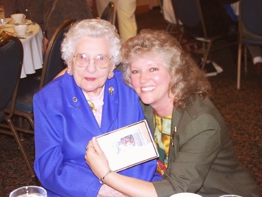
Her recipe makes apple pie sound simple and easy. I suppose it was for her. I interviewed Connie several times in her twilight years and attended her 100th birthday party in Kittery, Maine on June 4, 2001. The photo below was taken at the party. I had presented Connie with a framed a picture of herself and me during my first interview with her in 1987. Her comment was: "Well, my dear....thank you so much. I will cherish this, as I do your longtime friendship. And we do both look a bit younger in that photo!"


My friend and fellow lighthouse author, Jeremy D'Entremont posted a brief interview with Connie on You Tube. Find it here: https://www.youtube.com/watch?v=DKiQlKH2Gew.

As for lighthouse coffee, that's a topic for another day...perhaps a colder day...or National Coffee Day.


Thursday, January 16, 2014

A Lighthouse Memorial to an Aviator

Today, January 16th, is the 76th anniversary of the dedication of the Amelia Earhart Memorial Lighthouse. The lighthouse--as diminutive as Amelia was--flashed on at Howland Island in the mid-Pacific on January 16, 1938. This was the island where Amelia Earhart had planned to land, refuel, and rest on July 2, 1937 before finishing her celebrated round-the-world flight. Sadly, she never found Howland Island and vanished into history. Below is an article I wrote for the U.S. Lighthouse Society journal, The Keepers Log, a few years ago. Another version of the story also appears in the DeWire Guide to the Lighthouses of Alaska, Hawai'i, and the U.S. Pacific Territories. 

It's a fascinating tale of bravery, tragedy, and honor...


Howland Island Lighthouse
A Light for Amelia Earhart 


            The vast Pacific Ocean is home to numerous groups of islands, some so tiny, far-flung, and isolated that many of us have never heard of them. Howland Island, a mere sandbank adrift in cerulean seas and distant from civilization, might fit that description, except for the fact that it gained fame seventy-five summers ago when it played a significant role in the disappearance of America’s most famous aviatrix.
            Amelia Earhart, the daring young flyer who attempted to circumnavigate the equator in 1937, vanished along with her co-pilot, Fred Noonan, near Howland Island on the trans-Pacific leg of her historic final flight. Investigators of the incident believe “Lady Lindy,” as she was affectionately nicknamed, lost her way and crashed into the ocean not far from Howland Island. Her last radio transmission, received by the Coast Guard cutter Itasca, anchored off the island, noted:

WE ARE ON THE LINE OF POSITION 157 – 337. WILL REPEAT THIS MESSAGE. WE WILL REPEAT THIS MESSAGE ON 6210 KC. WAIT…LISTENING ON 6210.

             A garbled message, “we are running north and south” followed. Then Amelia Earhart vanished into history. Today, she is remembered in many ways, lending her name to scholarships, streets, parks, festivals, wildlife sanctuaries, bridges, and ships, but also to a lighthouse on Howland Island. The 74-year-old sentinel known as Amelia Earhart Light is modest in size and has been tested by war and weather. It ceased operation in 1996 and was downgraded to a daybeacon. Yet, the story of how it came to be and how it shines as a memorial to feminine determination and pluck surely would make Amelia Earhart proud.

         *                    *                      *                      *                   *       
            Shaped like a pickle and only two miles long and a half-mile wide, Howland Island is a pile of pulverized, sunburned coral fringed by extensive reefs. It is situated near the equator at 0º48’07” North and 176º38’3” West about 1,900 miles south-southwest of Honolulu and is part of a scattering of coral atolls called the Phoenix Islands. The island was named in 1842 for a crewman aboard the whaler Isabella, who spotted it from the ship’s crow’s nest while watching for humpback whales. He spied a clump of pisonia trees growing near the island’s center, along with some grasses and low shrubs. The apron of reefs around the island was festooned with the ribs of an old shipwreck that had occurred there years before. Whether the ship’s crew survived or perished is unknown, but the vessel gave the island its only mammal population—a horde of hearty castaway rats.


            In 1857 Howland Island was acquired by the United States under the Guano Islands Act passed the previous year. Fertilizer ships rushed to the site and harvested the brick-hard guano deposits, created by seabirds, within two decades. Stripped of its only bounty, Howland Island then grew quiet for almost eighty years.
            In the early 1930s, the island became part of the United States Minor Outlying Islands. Besides Howland Island, this designation also included the islands known as Baker, Jarvis, Wake, the Midways, and Johnston Atoll and Kingman Reef. Interestingly, these small isles, along with the Marshall Islands, Gilbert Islands, Christmas Island, and the Hawaiian Islands, form a huge 2,500-mile-diameter circle around the Central Pacific Basin which navigators have long known as a waypoint on trans-Pacific sea voyages and flights. The Polynesians, who were perhaps the best seat-of-the-pants navigators of all time, knew these islands like the backs of their hands.
            The United States failed to see them as useful, however. What would they do with these small, flat, nearly lifeless atolls? They were unfit for habitation, with no fresh water and little natural resource value. Some seemed strategically located for military purposes, but there was no war in the Pacific in the 1930s. In fact, there was little evidence anyone had ever lived on any of the Phoenix Islands.
            In 1935 an experiment of sorts began with the establishment of a small settlement on Howland Island called Itascatown. Boys from the prestigious Kamehameha School in Honolulu were brought to the island on the Coast Guard cutter Itasca to live for short stints and work as weather observers and marine science investigators. A lesser known goal for the project was to see how well the group of young men survived on a lonely, desolate island—a test of the human spirit. Similar colonies were set up on nearby Baker Island and Jarvis Island as well. It was a project that easily could have inspired William Golding’s 1954 novel Lord of the Flies.
            Not until 1937 was a more publicized and perhaps practical use was found for Howland Island. Someone had her eye on it, and she was famous. The island lay almost directly on the 2,556-mile air route Amelia Earhart planned to fly from Papua, New Guinea to the coast of South America where she would be celebrated as the first woman to fly around the world. Earhart and her navigator, Fred Noonan, decided Howland Island would be a good place to land, rest, and refuel. This prompted the United States to build Kamakaiwi Airfield on the island as a Great Depression era WPA project. Officials noted that it would serve not just Amelia Earhart’s flight but other trans-Pacific flights as well. The airfield was named for James Kamakaiwi, one of the first boys from the Kamehameha School to live on Howland Island. It consisted of three unpaved runways, any of which could accommodate Earhart’s twin-engine Lockheed Model 10 Electra, her plane of choice for the historic flight.
            Almost all airfields had airway beacons at the time, and the U.S. Bureau of Lighthouses was responsible for many of these beacons through its Airways Division. The plans for Kamakaiwi Airfield included a tower of sorts that would double as an airway beacon and a sentry for shipping. Howland Island had no natural harbor and making a landing by ship was difficult, given the extensive reef system. With an airfield added, the beacon would do double duty.
            Enormous publicity for the Earhart flight gripped the American public and the aviation industry that year. Press releases, public appearances, photo ops, and radio talks boasted Earhart’s aviation acumen and her desire to do something no other woman had done. The 39-year-old aviatrix had earned the Distinguished Flying Cross and had successfully crossed the Atlantic Ocean flying solo. Everyone was sure her Pacific flight also would end in success.
            No one knows what really happened after Amelia Earhart and Fred Noonan left Lae, New Guinea. Though The Boston Globe listed Earhart as “one of the best women pilots in the United States,” others said her skills were ordinary and noted she took unnecessary risks. Her trans-Atlantic flight from Newfoundland to Wales in June 1928, only a year after Charles Lindbergh’s flight from New York to Paris, propelled her to stardom. But even she knew she had not really flown across the ocean. Two other occupants of the plane had done the work and she had gone along for the ride.


            Even so, Earhart wrote a book, went on a lecture tour, and hyped ads for cigarettes and women’s fashions. Her popularity soared as she became the shy but accomplished female idol of her day. To prove she could fly on her own, she made a solo flight across the continental United States later in 1928. In 1931 she set an altitude record, began racing in planes, and was described as an expert “stunt flyer.” That same year she married her book publisher, George P. Putnam, and surprised the public by keeping her last name and announcing that she and her husband were equals with “dual control.” Amelia Earhart had developed a penchant for setting records in the air and in social circles.
            In May 1932 Earhart finally proved her mettle by flying solo from Newfoundland to Ireland in 14 hours 56 minutes. (The pasture in Ireland where she landed is now occupied by a museum.) Congress awarded her the Distinguished Flying Cross and First Lady Eleanor Roosevelt climbed in a plane with Earhart to demonstrate the strength and will of women. In 1935 Amelia Earhart flew solo from Honolulu to Oakland, then from Los Angeles to Mexico City and on to New York City. She set several distance and speed records and then announced she would undertake the greatest flight yet—a round-the-world flight over the equator.
            A first attempt in March 1937 resulted in mechanical problems with Earhart’s plane and issues with the navigation system. She reconnoitered and planned a new route. Three months later she was in the air, on her way into the history books. Earhart and co-pilot Fred Noonan left Miami on June 1, 1937, stopped in Puerto Rico, then crossed the Atlantic Ocean to Africa and passed over the Red Sea to the Indian Ocean. Next they flew to Karachi, India and then to Rangoon, Bangkok, Singapore, and Bandoeng. They landed at Darwin, Australia where they rested and then flew on to Lae, New Guinea on June 29, 1937. By this time Earhart had logged about 22,000 air miles and had only about 7,000 miles to go. The remainder of the round-the-world flight would take her over the vast Pacific Ocean, to Howland Island with its special runways and beacon, and then on to South America.
            The two intrepid aviators left New Guinea at midnight July 2. Throughout the night they were in contact with the Coast Guard cutter Itasca, anchored just off Howland Island. Radio-direction-finding (RDF) for air travel was new and, according to Noonan, lacked reliability. The two tried to back up their radio navigation with old fashioned calculations of sunlines. Some historians say Earhart lacked skill at operating the RDF system, and possibly the antenna for the radio mounted underneath the fuselage was somehow torn away, perhaps during takeoff. There was conjecture about the effect of a headwind on Earhart’s travel time estimates too. No matter the cause of the problem, it appears Earhart could not hear radio transmissions from the Itasca and this crippled her sense of position.
            At 7:42 in the morning she radioed “We must be on you but cannot see you,” and reported flying at an altitude of 1,000-feet and her plane running low on gas. About fifteen minutes later, another message indicated she wanted voice transmissions from the Itasca instead of radio, but the ship’s communications console was unable to send them and opted for Morse Code instead. Earhart heard the coded messages but could not determine the Itasca’s position from them. Around 8:45 the Itasca received Earhart’s last transmission, a broken message that could barely be heard. They tried in desperation to push smoke in the air from the ship’s oil-fired boilers in hopes she would see it. The airway beacon was of little use in the daylight. Then, the radio was eerily silent. Amelia Earhart disappeared, never to be heard from again.
            A search began within the hour, with the Itasca making north-south sweeps of the ocean around Howland Island. Pan American Airways claimed they received signals from Earhart over the next few hours and estimated the signals originated near uninhabited Gardner Island. This meant the plane may have run out of fuel and crash-landed on the island, since a water landing would have shorted out the plane’s electrical system and prevented radio transmissions.
            The Itasca was quickly joined by at least three other ships and several planes to make a thorough search of a broad expanse of sea in the Phoenix Islands. Other planes and ships joined the search, to the tune of $4-million. Later in the month, when the government had abandoned its effort, Earhart’s husband launched his own extensive search but nothing was found. The best guess was that Amelia Earhart and Fred Noonan crashed into the sea about 120 miles northwest of Howland Island. Amelia Earhart was declared dead in January 1939.
            The public was shocked. Earhart had a strong cult following by this time and her astute media mogul husband had promoted her round-the-world flight with press releases to newspapers throughout the planning phase and with short articles and quotes from his wife as each leg of the journey was completed. The media blitz during the search effort only whetted the public appetite for more Earhart news and probably influenced the U.S. Lighthouse Service’s decision to build a lighthouse in her memory.
            The sentinel would be a memorial for Amelia Earhart but also a safety measure for all seamen and aviators traveling over the central Pacific. And not just Howland Island would be lighted. The U.S. Bureau of Lighthouses decided to build genuine lighthouses on several of the Phoenix Islands.
            A notice in the Seattle Times in December 1937 detailed the proposed lighthouses:

            Oh, for the life of a lighthouse keeper on Howland Island or Baker or Jarvis Islands!
            These three overgrown reefs in the mid-Pacific, far south of Hawaii, soon will have lighthouses for the first time and keepers to keep them dark except when they get radioed instructions to light the lights from faraway Honolulu.
            It would appear to the novice that keeping the lights on those tiny equatorial islands would be about the most restful jobs in the world.
            Lighthouses with 190-candlepower flashing lights are reported nearing completion on each of the islets, but because of their extreme isolation the lights will be lighted only on specific requests of shipmasters or pilots of transpacific [sic] airplanes cruising in the vicinity.
            The request system will work as follows:  When a vessel or plane approaches the islands and desires the beacon be lighted the master will radio his request to the superintendent of lighthouses at Honolulu, who will, in turn, radio the keepers of the lights 2,000 miles away with instructions to turn on the lights.
            More definite instructions it is said will be contained in a near-future notice to mariners published by the lighthouse service and Navy hydrographic office.


            Life Magazine’s January 3, 1938 issue showed a group photo of men on Howland Island laying the cornerstone of the Earhart Lighthouse. The new structure, a 20-foot tall conical stone tower with an exposed small beacon on top, was being built under the direction of Ernest Gruening, former governor of Alaska and by this time the Director of the Division of Territories and Insular Possessions for the Department of the Interior. The ship Roger B. Taney set sail from Honolulu in November 1937 with a construction crew and materials, plus Gruening, who carried a set of blueprints. The cornerstone was laid November 17, 1937, five months and fifteen days after Amelia Earhart’s disappearance.
            The sentinel was completed by the end of the year on the island’s highest spot 25-feet above sea. The light’s focal point was 46 feet, an acetylene gas light that flashed once every four seconds. The keeper could access the beacon using an exterior ladder or from the inside. It was to serve as both an active aid to navigation and a memorial to the lost aviatrix, Amelia Earhart.
            The whitewash was barely dry on the new Amelia Earhart Lighthouse when World War II began. The few inhabitants of the island were quickly evacuated and Japanese bombers enjoyed practice runs over the island, destroying the runways that only a few years before had waited in vain for Earhart’s plane to touch down, and damaging the pretty white lighthouse dedicated to her bravery.


            By 1945 the lighthouse was a shambles, with the light out and most of its upper portion gone. The top of the tower was amateurishly rebuilt after the war and the beacon was reinstated, but it was a shadow of its former self. Amelia Earhart Lighthouse never again looked as lovely as in 1937 when it was first completed. In 1996, the Coast Guard discontinued the light. Today, Amelia Earhart Lighthouse is a crumbling daybeacon and an oddity for the few visitors to the island.

            Howland Island National Wildlife Refuge, established in 1974, surrounds the old tower and comprises the 455 acre island and 34,074 acres of reefs around it. It is part of the greater Pacific Remote Islands Marine National Monument. Access is by permission of U.S. Fish & Wildlife. While park rangers visit the island once every two years, it truly is a memorial now, quiet and undisturbed.

Women must try to do things as men have tried. When they fail their failure must be but a challenge to others.


Amelia Earhart, Last Flight


(Photos are from various sources: Wikimedia Commons, National Geographic, the Coast Guard Historian, and the National Park Service)